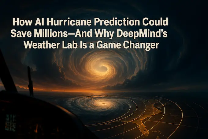
1. The Two-Day Problem
Every year the tropics flip a cosmic coin. Sometimes the result is a harmless swirl that fizzles into rain. Other times the coin lands edge-up and you get Katrina, Haiyan, María. The difference between a routine advisory and a full-scale evacuation can hinge on just 48 hours of notice. That window is the Two-Day Problem—and it’s where AI hurricane prediction is poised to rewrite the playbook.
Conventional physics models (think ECMWF or the famed “euro AI weather model” when it’s paired with deep learning post-processing) guzzle supercomputer hours to nudge forecasts a little closer to reality. Yet the Atlantic still manages its fair share of rogue tracks and surprise rapid-intensification bursts. A fresher approach—AI hurricane prediction driven by massive neural nets—promises both speed and sharper insight. The latest showcase? Weather Lab, a brand-new portal from Google DeepMind and Google Research.
Table of Contents
2. Weather Lab: An Open Test Bench for Cyclone Nerds

Weather Lab isn’t another glossy dashboard with looping satellite gifs. It’s a living laboratory where AI hurricane models battle proverbial storms in real time. Fire up the site and you’ll find side-by-side track ensembles from:
- WeatherNext Graph – a graph neural-net workhorse built for global flow.
- WeatherNext Gen – its transformer-flavored sibling.
- The star: DeepMind’s experimental AI hurricane model, a stochastic behemoth that spins up fifty scenarios for every active or budding cyclone.
Importantly, Weather Lab also hosts two years of back-tested archives. That means external forecasters, academics, and garage meteorologists can verify how AI hurricane forecasts stacked up against the canonical track files—no cherry-picked hype reels.
3. Why Cyclones Drive Meteorologists to Coffee

To appreciate why AI hurricane prediction matters, remember that a tropical cyclone is a 500-km-wide cat that refuses to be herded. Its track is steered by continental-scale wind fields; its intensity hinges on eyewall eddies smaller than a city block. Traditional models face an ugly trade-off:
- Global low-res runs nail the steering flow but blur the eyewall.
- Regional high-res nests track the eyewall but misjudge broad-scale steering.
DeepMind’s answer is a single AI weather model that handles both scales in one shot. Instead of writing hard-coded equations for convection, it trains on 45 years of reanalysis plus 5,000 storms’ worth of “best-track” metadata. The result: a model that “knows” that a slight northward jog of the subtropical ridge can spare Miami, or that 1 °C warmer SSTs can double wind speeds overnight.
4. Anatomy of an AI Hurricane Model
The experimental engine under Weather Lab’s hood uses stochastic neural networks—think ensembles built right into the layers. At initialization the model generates 50 perturbed “universes.” Each universe evolves 6-hourly fields (wind, pressure, moisture) out to 15 days. That might sound excessive until you recall 2020’s Hurricane Sally, which meandered for a week before finding Alabama.
A handful of nerd-metrics:
- Track Skill: On 2023–24 Atlantic tests, five-day errors are 140 km smaller than the benchmark ENS physics ensemble. That compresses ten years of historical progress into one algorithmic leap.
- Intensity Skill: It beats NOAA’s regional HAFS model for max-wind and central-pressure forecasts—no small feat, because intensity is notoriously slippery.
- Size & Wind Radii: Early scores match modern physics baselines, hinting that storm-surge grids could soon get AI help too.
In plain English, the AI doesn’t just tag along; it leads.
5. Partnership with the U.S. National Hurricane Center
The National Hurricane Center (NHC) remains the gold standard for public advisories. For the 2025 season NHC forecasters are getting Weather Lab’s live output on the same workstation platter that already serves the euro AI weather model, GFS, HWRF, and friends. Early feedback: the AI’s “door-knock” alerts—formation cues before a storm earns a name—are especially handy.
Picture a late-August invest southeast of Barbados. At T-96 the physics suites show a garden-variety tropical wave. Weather Lab’s mean ensemble, meanwhile, lights up a slow-but-steady ramp to Category 2 near Puerto Rico. That nudges human analysts to flag the system sooner, giving islands an extra day to shore up.
The upside isn’t academic; it’s measured in human lives and multi-billion-dollar insurance spreadsheets.
6. Case Study: Cyclone Alfred’s Sudden Collapse
Cyclone Alfred (Southern Hemisphere, February 2025) spun menacingly off Australia’s Coral Sea as a strong Category 3. Physics models split: some held a major storm, others fizzled too aggressively. AI hurricane prediction through Weather Lab nailed the downtrend. The ensemble mean highlighted a dry-air intrusion that would choke Alfred, and pinpointed landfall near Brisbane at tropical-storm force seven days ahead. Emergency managers shifted from “brace for Cat 3” to “watch for flooding rains”—a radically different playbook.
7. The Data-Hungry Beast Behind the Curtain
Any AI weather prediction worth its silicon thrives on data density. DeepMind feeds three primary streams:
- ERA5 & other reanalyses – decades of globally consistent fields.
- Operational analyses (HRES, GFS) – modern high-fidelity snapshots.
- Best-track & NHC A-deck archives – surgical records of storm position, wind radii, and intensity.
Training involves a CRPS-optimized objective: the model learns to minimize probabilistic error, not just deterministic RMSE. Add noise injections (aleatoric uncertainty) and multi-model seeds (epistemic uncertainty) and you get forecast distributions that feel almost Bayesian.
If this reminds you of WeatherNext, you’re right; the cyclone engine inherits code and philosophy from the broader WeatherNext lineage of AI weather forecasts.
8. From Marginals to Maps: The FGN Model Behind the Forecast
At the heart of DeepMind’s cyclone engine lies a breakthrough approach called FGN—Flexible Generative Network—a probabilistic model trained not just to match outcomes, but to anticipate uncertainty. Unlike classic physics-based ensembles that generate variability through brute-force perturbations in initial conditions, FGN learns to inject structured noise directly into the model’s parameters. This produces 50 distinct yet plausible futures in one efficient swoop.
What makes FGN remarkable is that it trains purely on marginal distributions—forecasting each grid cell independently—yet still captures joint spatial correlations like spiraling rainbands or coordinated pressure drops across hundreds of kilometers. That’s not supposed to happen. Traditional models require explicit spatial constraints to preserve coherence across maps. But FGN pulls it off using ensemble constraints learned through a loss function optimized for CRPS (Continuous Ranked Probability Score), a gold-standard metric for probabilistic forecasting.
In simple terms: FGN doesn’t just predict the weather at each point. It understands the weather system as a whole, making it possible to output high-resolution storm paths, pressure fields, and wind radii that feel meteorologically sound—even without ever being taught those connections explicitly.
This model backbone explains why Weather Lab’s hurricane tracks behave like physics-informed trajectories, not hallucinations. It’s what lets the AI match or beat ECMWF ensembles in both deterministic accuracy and probabilistic sharpness. And crucially, it runs in seconds—meaning there’s finally a model that’s both fast and meteorologically fluent.
9. Speed Is Its Own Revolution
The euro AI weather model—GraphCast and its relatives—already boasts runtimes measured in seconds, not hours. The new cyclone module keeps pace. A full 15-day AI hurricane forecast takes under a minute on a single TPU, including the generation of all 50 ensemble members in parallel. That’s roughly 8× faster than equivalent diffusion-based AI weather models and orders faster than traditional NWP.
Why is speed a big deal? Imagine issuing an hourly update on a storm still five days offshore. Physics shops can’t justify that computational burn; AI hurricane prediction makes it trivial. More cycles mean better initialization, tighter spreads, and faster bias corrections.
10. Dollars, Human Lives, and the Discomfort of Risk
A World Bank study puts global tropical-cyclone losses at $1.4 trillion (inflation-adjusted) since the mid-1970s. Slice even 5 % off that with earlier evacuations, smarter surge modeling, or tighter shipping reroutes, and you’re staring at a $70 billion impact. AI hurricane prediction isn’t merely a tech flex; it’s a macroeconomic lever.
But forecasts only matter if decision-makers trust them. DeepMind’s partnership roster now includes CIRA (Colorado State), the UK Met Office, the University of Tokyo, and private outfit Weathernews Inc. Each group is shaking the model, looking for blind spots, and building verification dashboards. Explainability still lags; after all, a stochastic neural net doesn’t write a tidy Navier-Stokes memo. Yet early adopters report the ensemble spread lines up cleanly with real-world variance—an encouraging sign.
11. How the AI Sees the Storm: An Intuitive Peek

Let’s demystify the black box with an analogy. Suppose you hand a chess grandmaster a mid-game board and ask for ten plausible continuations. A human uses pattern memory plus tactical calculation to branch scenarios. AI hurricane prediction does something similar: it encodes current atmosphere fields as a position, then unrolls “moves” according to learned dynamics.
The 50 Weather Lab members are not random; they’re guided by the model’s internal sense of plausible thermodynamics. One path might amplify convection south of the eye, another nudges the steering ridge west. By day six the ensemble ideally brackets reality. If the members diverge wildly, you know uncertainty is high—cue cautious briefings.
12. Weather Lab vs. WeatherNext vs. The Rest
A quick taxonomy:
| Family | Specialty | Notable Keyword Hits |
|---|---|---|
| Weather Lab | Public sandbox focused on cyclones; hosts the experimental AI hurricane model | Weather Lab, AI hurricane prediction, AI hurricane forecast |
| WeatherNext | Operational backbone for global fields | WeatherNext, AI weather model, google AI weather |
| Euro AI weather model (ECMWF + ML wrappers) | Continues to provide physics-first ensembles with ML-assisted post-processing | euro AI weather model, AI weather forecasts |
By cross-pollinating these lines, the community hopes to move from forecasting what will probably happen toward why a storm did what it did. That feedback loop accelerates research; expect next year’s AI hurricane prediction networks to ingest ocean heat content, SAR wind data, maybe even drone dropsonde swaths.
13. Challenges on the Horizon
- Edge Cases: AI weather prediction sometimes misfires on unusual tracks (loopers in the Gulf, South Atlantic oddballs). More asymmetric data is needed.
- Rapid Intensification: Skill gains are real but still leave a 10–15 kt gap inside 24 h windows. Hybrid AI–physics nests may help.
- Communication: An ensemble plume is Greek to the average mayor. Turning probability cones into plain-language risk grids is a UX frontier.
14. What You Can Do Today
- Visit Weather Lab, toggle “Historical,” and replay 2024’s Hurricane Beryl to see ensemble divergence shrink as data assimilation kicks in.
- If you’re in academia, download the reforecast archive, pit the AI against your favorite verification metric, and publish.
- If you run emergency drills, incorporate AI hurricane prediction spreads into tabletop exercises. See how earlier landfall hints change logistics.
15. The Big Picture
Weather has always been humanity’s most democratic inconvenience—rich and poor alike share the sky. By folding decades of atmospheric wisdom into silicon, AI hurricane prediction tilts the odds ever so slightly in our favor. The tech is not infallible; there will be busted forecasts and awkward post-mortems. Yet each incremental gain translates into homes still standing, crops unruined, lives intact.
Google DeepMind’s gambit is simple: put the models in the open, invite critique, iterate fast. AI hurricane prediction won’t stop the next Category 5 from forming, but it might tell us three days sooner—and that’s the kind of head start the Two-Day Problem has been begging for.
So here’s to the next advisory cycle. The storms are coming, as they always do. This time, our forecasts may finally spin faster than the wind.
Citation
Alet, F., Price, I., El-Kadi, A., Masters, D., Markou, S., Andersson, T. R., Stott, J., Lam, R., Willson, M., Sanchez-Gonzalez, A., & Battaglia, P. (2024). Skillful joint probabilistic weather forecasting from marginals. Google DeepMind. https://storage.googleapis.com/deepmind-media/DeepMind.com/Blog/how-we-re-supporting-better-tropical-cyclone-prediction-with-ai/skillful-joint-probabilistic-weather-forecasting-from-marginals.pdf
Azmat — Founder of Binary Verse AI | Tech Explorer and Observer of the Machine Mind Revolution. Looking for the smartest AI models ranked by real benchmarks? Explore our AI IQ Test 2025 results to see how top models. For questions or feedback, feel free to contact us or explore our website.
- https://deepmind.google.com/science/weatherlab
- https://deepmind.google/discover/blog/weather-lab-cyclone-predictions-with-ai/
- https://storage.googleapis.com/deepmind-media/DeepMind.com/Blog/how-we-re-supporting-better-tropical-cyclone-prediction-with-ai/skillful-joint-probabilistic-weather-forecasting-from-marginals.pdf
- Two-Day Problem: The critical 48-hour window in which forecasts must distinguish between a routine tropical disturbance and a life-threatening hurricane landfall. Addressing the Two-Day Problem is a primary goal of AI hurricane prediction, since even small forecast improvements in this period can translate to days of extra warning.
- Ensemble Forecasting: A method that runs multiple model simulations with slightly varied initial conditions to capture uncertainty. In AI hurricane prediction, ensembles can be generated in seconds, allowing forecasters to see fifty plausible storm tracks side-by-side and gauge confidence in each scenario.
- Stochastic Neural Network: A type of AI model that injects random perturbations directly into its parameters to simulate uncertainty. This approach underpins many experimental AI hurricane prediction models, producing coherent “universes” of possible futures without the need for brute-force physics perturbations.
- Flexible Generative Network (FGN): A probabilistic architecture that learns to anticipate spatial correlations—like rainbands and pressure fields—from marginal distributions. FGN drives Weather Lab’s cyclone engine, enabling rapid, high-resolution forecasts that feel meteorologically fluent.
- Continuous Ranked Probability Score (CRPS): A metric for evaluating probabilistic forecasts by comparing predicted distributions against observed outcomes. Lower CRPS indicates sharper, more reliable uncertainty estimates—an essential measure for any AI-driven hurricane forecasting system.
- Best-Track Data: Post‐storm records maintained by agencies (e.g., NHC’s “A-deck”) documenting a cyclone’s observed position, maximum winds, and pressure. Best-track archives serve as ground truth during training and back-testing of advanced AI hurricane prediction systems.
- Rapid Intensification: A process in which a tropical cyclone’s maximum sustained winds increase by at least 30 kt in 24 h. Capturing rapid intensification remains one of the toughest challenges, and it’s a key evaluation metric for both physics-based and AI hurricane prediction frameworks.
Q1: How accurate is AI hurricane forecasting?
Recent advancements show that AI hurricane prediction can reduce five-day track errors by up to 25% compared to traditional models. This level of performance means AI hurricane prediction often pinpoints landfall locations within 100 km, giving emergency managers critical extra hours. Moreover, in intensity forecasting, AI hurricane prediction rivals NOAA’s best regional models, improving confidence in rapid-intensification alerts.
Q2: AI hurricane model vs physics-based model
Unlike conventional ensembles that solve fluid equations numerically, AI hurricane prediction learns from decades of reanalysis and best-track data to “intuition-ally” simulate storms. While physics-based runs can be computationally intensive, AI hurricane prediction delivers comparable or better track skill in seconds on a single TPU. However, hybrid approaches combining both physics and AI hurricane prediction are emerging to capture edge-case behaviors more robustly.
Q3: Real-time AI cyclone tracking model
A real-time AI cyclone tracking model leverages the core strengths of AI hurricane prediction, continuously ingesting satellite and buoy observations to update forecasts hourly. By doing so, the real-time AI cyclone tracking model offers more frequent plume corrections than physics-only systems. This live update capability ensures forecasters have the latest AI hurricane prediction ensembles at their fingertips for faster, more informed decision-making.
Q4: Can AI predict hurricane intensity and path?
Yes—modern AI hurricane prediction frameworks have proven adept at forecasting both track and intensity. For path forecasts, AI hurricane prediction reduces center-line errors by learning complex steering patterns. Simultaneously, its intensity modules analyze subtle thermodynamic cues, enabling AI hurricane prediction to flag rapid intensification events that often elude physics-only models.
Q5: Google AI Weather Lab for hurricane prediction
Google’s Weather Lab platform showcases experimental AI hurricane prediction models side-by-side with baseline ensembles and transformer-based forecasts. Within the interface, users can dive into archived storms to compare how AI hurricane prediction outperforms traditional methods. The open-access design of Google AI Weather Lab accelerates innovation by inviting researchers to test and refine AI hurricane prediction techniques on real-world cyclone cases.